
COMMENTS ARE NOW CLOSED.
We've taken Richmond's new community vision and input from all of you, and used those to create a draft Future Land Use Map. Thanks to all who took the time to comment on these drafts!
Read on to learn more about Future Land Use Maps and what's included in ours, and how they further Richmond’s vision for the future.
Read on to learn more about Future Land Use Maps and what's included in ours, and how they further Richmond’s vision for the future.
About Future Land Use maps
What is Future Land Use Map? A future land use map graphically communicates important components of a community’s vision for change, investment, and preservation. This map doesn’t necessarily reflect current land uses, but rather what we want land use to be in the future. In short, the map is a prescription for future growth and a guide for managing land use change.
Is this a new zoning map? No, but it is the basis for a zoning map. It does not take away any property rights or create property rights. The land use classifications are broad, reflecting only general land uses such as a village center, neighborhood, agriculture, industrial, or conservation. When it comes to implementing the plan through zoning bylaws, we may need to create multiple zoning districts within each land use category to address the nuances of our community.
Draft Future Land Use Maps
Option A: Basic Map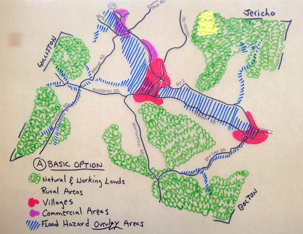
Simple representation of a handful of future land uses. The areas lump together similar land use types. The generalized descriptions contained within the plan will provide flexibility, but will require more decision-making when we draft new zoning regulations.
Natural and Working Lands:
Rural Areas:
Villages:
Commercial Areas:
Flood Hazard Overlay Area:
|
Option B: Detailed Map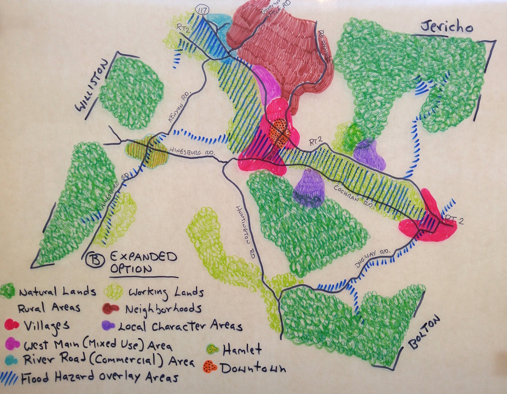
Detailed representation of a variety of future land uses. The areas aim to define the different characteristics of different desired future land use types. The more detailed descriptions contained within the plan will provide a clearer direction for drafting new zoning regulations.
Natural Lands:
Working Lands:
Rural Areas:
Hamlet:
Neighborhoods:
Villages:
Downtown:
West Main Mixed Use Area:
River Road Commercial Area:
Local Character Areas:
Flood Hazard Overlay Area:
|
